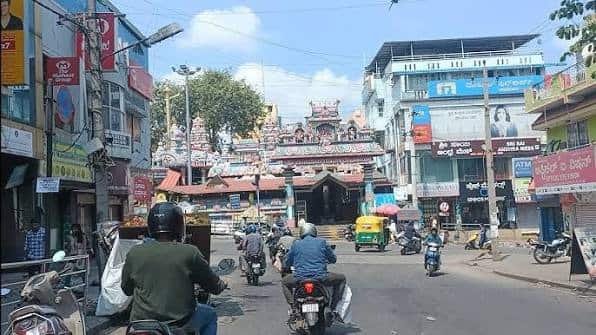
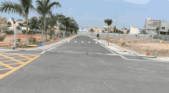
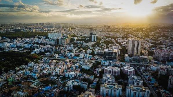
Madiwala 1st Stage, BTM Layout is a well-connected residential pocket in south Bengaluru, close to Madiwala, Koramangala, Hosur Road and Central Silk Board. The address is commonly used for streets on the Madiwala-facing side of BTM 1st Stage and falls under PIN code 560068. The locality combines independent houses, apartments, PG accommodation, shops, eateries and everyday services. Its biggest advantage is location: Koramangala is nearby, Outer Ring Road is accessible through Silk Board, and the operational Yellow Line offers metro connectivity towards RV Road and Electronic City.
| Madiwala 1st Stage Quick Details | Information |
| Locality | Madiwala, 1st Stage, BTM Layout |
| Common Address Form | Madiwala 1st Stage / BTM Layout 1st Stage |
| Where it is located | South Bengaluru |
| City | Bengaluru / Bangalore |
| State | Karnataka |
| District | Bengaluru Urban |
| Pin Code | 560068 |
| Postal Area | Madivala |
| Major Roads | Hosur Road, Outer Ring Road and BTM internal roads |
| Nearby Areas | Madiwala, Koramangala, BTM 2nd Stage, Tavarekere, HSR Layout, Bommanahalli |
| Nearest Major Operational Metro | BTM Layout station – Yellow Line |
| Other Useful Metro Access | Jayadeva Hospital and Central Silk Board – Yellow Line |
| Airport | Kempegowda International Airport |
| Known For | Central location, Koramangala access, rentals, food and strong road/metro connectivity |
Where is Madiwala 1st Stage, BTM Layout Located?
Madiwala 1st Stage lies on the Madiwala-facing side of the broader BTM 1st Stage area, close to Koramangala and the Hosur Road corridor. It sits within the dense south Bengaluru belt between Madiwala, BTM Layout, Tavarekere and Central Silk Board. Homes near main roads have faster access to buses, shops and workplaces but usually see more traffic, while internal cross roads are more residential. The locality is generally associated with PIN code 560068 under the Madivala postal area.
Areas Near Madiwala 1st Stage, BTM Layout
The locality is surrounded by several major residential, educational and commercial areas of south Bengaluru.
- Madiwala adjoins the area and provides quick access towards Hosur Road, St. John’s Medical College and the Koramangala side.
- Koramangala is one of the closest major commercial and employment areas, with offices, restaurants, shopping streets, colleges and hospitals.
- BTM 2nd Stage lies towards the south and southwest, while Tavarekere and Suddagunte Palya are accessible towards the Bannerghatta Road side.
- Central Silk Board, Bommanahalli and HSR Layout are important nearby areas for commuters travelling towards Outer Ring Road, Hosur Road and Electronic City.
- Jayanagar, JP Nagar, MICO Layout and parts of Adugodi are also within practical commuting distance depending on the starting street and traffic conditions.
Road Connectivity
Hosur Road is the main corridor towards Bommanahalli, Singasandra and Electronic City, while Outer Ring Road can be reached through Central Silk Board for travel towards HSR Layout, Bellandur and eastern Bengaluru. Internal BTM roads connect the area with Jayadeva, Bannerghatta Road, Jayanagar and JP Nagar. Koramangala is geographically close, but Madiwala and Silk Board can become heavily congested during office hours. For daily commuting, the exact exit road from the house often matters more than straight-line distance.
Metro Connectivity
Madiwala 1st Stage benefits from the operational Yellow Line of Namma Metro. BTM Layout station is a practical option for many residents, while Jayadeva Hospital or Central Silk Board may be more convenient from some streets. The Yellow Line runs from RV Road to Delta Electronics Bommasandra, serving the Electronic City corridor and connecting with the Green Line at RV Road. Jayadeva Hospital will also interchange with the Pink Line. As of September 6, 2026, the first Pink Line stretch is awaiting final approvals and has not yet opened for passengers.
BMTC Buses and Local Transport
BMTC buses are widely available along Madiwala-side roads, Hosur Road, Outer Ring Road and routes towards Koramangala, Silk Board, Jayanagar and central Bengaluru. Autos and app-based cabs are easy to find, while two-wheelers are common for short trips. Residents on deeper internal streets may need a short walk or auto ride to reach major bus corridors, whereas homes closer to the main BTM and Madiwala roads have stronger public-transport access.
Connectivity to IT and Employment Hubs
The locality is practical for people working across south and southeast Bengaluru. Koramangala is nearby, Electronic City is reachable through Hosur Road or the Yellow Line, and the Outer Ring Road employment belt around HSR Layout and Bellandur is accessible through Silk Board. Offices around Bannerghatta Road, Dairy Circle and Jayanagar are also within practical reach. Before choosing a rental, commuters should test the actual morning route because a nearby office can still require crossing a congested junction.
Airport and Railway Connectivity
Kempegowda International Airport is roughly 40 to 45 km away by road, depending on the route. Taxis, app-based cabs and airport bus connections from larger nearby corridors are commonly used. KSR Bengaluru City Railway Station near Majestic is one of the main railway terminals for residents. The Yellow Line connection to RV Road, followed by the Green Line, also provides a metro-based route towards Majestic. Peak-hour road traffic should be considered when planning airport or railway journeys.
Shopping, Food and Daily Needs
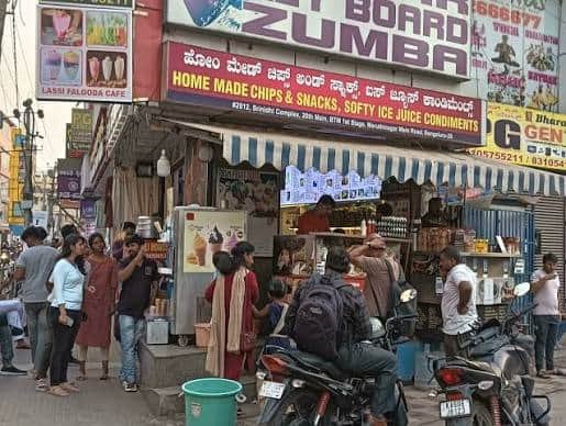
Daily needs are easy to manage locally. Madiwala has a busy market environment, while BTM 1st Stage has supermarkets, vegetable shops, pharmacies, bakeries, banks, gyms, salons and restaurants. Koramangala adds a larger choice of cafes, branded stores and entertainment. Main commercial streets stay active into the evening, while residential cross roads are usually calmer. This balance makes the area convenient for residents who want groceries, food delivery and routine services close to home.
Schools, Healthcare and Family Facilities
The wider Madiwala-BTM-Koramangala belt has schools, preschools, tuition centres, colleges, clinics and diagnostic facilities. St. John’s Medical College Hospital is a major nearby healthcare institution, while Jayadeva Hospital is accessible towards the Bannerghatta Road side. Christ University and several educational institutions around Hosur Road, Dairy Circle and BTM are also within easy reach. Families should still check school-bus access and pedestrian conditions on the exact street, as these vary considerably.
Parks and Open Spaces
Madiwala 1st Stage is a dense urban area, so large open spaces are limited. Smaller parks and playgrounds are available across the broader BTM area, while Madiwala Lake is one of the better-known open spaces nearby. Residents also use parks in BTM 2nd Stage and neighbouring layouts. People who value quieter surroundings should look at internal tree-lined streets, which can feel noticeably calmer than homes facing market roads or major traffic corridors.
Housing and Rental Character
Housing includes independent houses, older low-rise buildings, apartments, shared flats and PG accommodation. Rental demand is supported by proximity to Koramangala, colleges, hospitals, Electronic City routes and the Outer Ring Road employment belt. Before renting, ask about the water source, summer tanker dependence, parking, power backup, lift maintenance, internet and monthly maintenance charges. Older buildings may offer larger rooms, while newer properties often provide better lifts and parking but may cost more.
Traffic and Monsoon Conditions
Traffic is the main everyday concern. Madiwala, Central Silk Board, Hosur Road and the approaches towards Koramangala can become slow during weekday peak hours, while internal streets may see spillover traffic. During heavy rain, low-lying stretches in the wider Madiwala-Silk Board-BTM belt can face temporary waterlogging or slower traffic. Anyone planning to rent or buy should inspect the exact street during rush hour and, if possible, after rain, paying attention to drainage, basement parking and road level.
FAQs About Madiwala 1st Stage, BTM Layout
Q1. Which metro station is most practical for Madiwala 1st Stage residents?
BTM Layout station is useful for many residents, but the best station varies by street. Homes closer to Silk Board may find Central Silk Board more convenient, while some western streets may have easier access to Jayadeva Hospital. Compare the actual walking or auto route from the building rather than choosing only by station name.
Q2. How does this pocket compare with BTM 2nd Stage for someone choosing a rental home?
Madiwala 1st Stage generally gives quicker access to Koramangala, Madiwala and Hosur Road. BTM 2nd Stage has a broader residential and commercial spread and may suit people travelling more often towards Bannerghatta Road or JP Nagar. The better choice depends mainly on workplace direction and the immediate street environment.
Q3. What should a tenant check if the building is on an internal cross road?
Check whether autos and delivery vehicles can enter easily, the distance to a bus stop and supermarket, street lighting, and whether cars can pass comfortably when vehicles are parked. Also ask about water supply, garbage collection and drainage because these can vary even between nearby streets.
Q4. Is this area practical for someone working in both Koramangala and Electronic City?
It can be a convenient compromise. Koramangala is nearby by road, while Electronic City is connected through Hosur Road and the Yellow Line. The main variable is how quickly the specific building reaches the main corridor, so commuters should test the route during their normal office hours before finalising a rental.
Q5. Are main-road homes much noisier than homes inside the layout?
Usually, yes. Properties facing busy Madiwala-side roads or bus corridors can experience more horns, traffic and late-evening activity. Moving a few cross roads inside often makes a noticeable difference, though it may add a short last-mile trip to buses, shops or the metro.
Q6. Is car parking easy to find in older buildings here?
Not always. Many older houses and low-rise buildings were developed when car ownership was lower, so parking can be limited or dependent on the street. Anyone with a car should confirm a dedicated space, gate width and turning room before paying a deposit rather than assuming roadside parking will be available.
Q7. What is the most useful way to evaluate a property before renting in this locality?
Visit the property during the evening rush and again after dark. This reveals traffic noise, parking pressure, street lighting, local activity and the real walking route to shops or public transport. For ground-floor or basement properties, also ask neighbours about drainage and waterlogging during heavy rain.